1. Geographical location.
2. Geological structure and relief.
3. Climate.
4. Inland waters.
5. Soils, plant and animal world.
6. Natural areas and their anthropogenic changes.
Geographical position
The East European Plain is one of the largest plains in the world. The plain opens to the waters of two oceans and stretches from the Baltic Sea to the Ural Mountains and from the Barents and White Seas to the Azov, Black and Caspian Seas. The plain lies on the ancient East European platform, its climate is predominantly temperate continental and natural zoning is clearly expressed on the plain.
Geological structure and relief
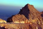
The East European Plain has a typical platform topography, which is predetermined by platform tectonics. At its base lies the Russian plate with a Precambrian foundation and in the south the northern edge of the Scythian plate with a Paleozoic foundation. At the same time, the boundary between the plates is not expressed in the relief. On uneven surface The Precambrian basement contains strata of Phanerozoic sedimentary rocks. Their power is not the same and is due to the unevenness of the foundation. These include syneclises (areas of deep foundation) - Moscow, Pechersk, Caspian and anticlises (protrusions of the foundation) - Voronezh, Volga-Ural, as well as aulacogens (deep tectonic ditches, in place of which syneclises arose) and the Baikal ledge - Timan. In general, the plain consists of hills with heights of 200-300m and lowlands. The average height of the Russian Plain is 170 m, and the highest, almost 480 m, is on the Bugulma-Belebeevskaya Upland in the Ural part. In the north of the plain there are the Northern Uvals, the Valdai and Smolensk-Moscow stratal uplands, and the Timan Ridge (Baikal folding). In the center are the elevations: Central Russian, Privolzhskaya (stratal-tiered, stepped), Bugulminsko-Belebeevskaya, General Syrt and lowlands: Oksko-Donskaya and Zavolzhskaya (stratal). In the south lies the accumulative Caspian Lowland. The formation of the plain's topography was also influenced by glaciation. There are three glaciations: Oka, Dnieper with the Moscow stage, Valdai. Glaciers and fluvioglacial waters created moraine landforms and outwash plains. In the periglacial (pre-glacial) zone, cryogenic forms were formed (due to permafrost processes). The southern border of the maximum Dnieper glaciation crossed the Central Russian Upland in the Tula region, then descended along the Don valley to the mouth of the Khopra and Medveditsa rivers, crossed the Volga Upland, the Volga near the mouth of the Sura, then the upper reaches of the Vyatka and Kama and the Ural in the region of 60°N. Iron ore deposits (IOR) are concentrated in the foundation of the platform. Reserves are associated with the sedimentary cover coal(eastern part of Donbass, Pechersk and Moscow region basins), oil and gas (Ural-Volga and Timan-Pechersk basins), oil shale (northwestern and Middle Volga region), building materials(widespread), bauxite (Kola Peninsula), phosphorite (in a number of areas), salts (Caspian region).
Climate
The climate of the plain is influenced geographical position, Atlantic and Arctic oceans. Solar radiation changes dramatically with the seasons. In winter, more than 60% of radiation is reflected by snow cover. The western transport dominates over the Russian Plain all year. Atlantic air transforms as it moves east. Behind cold period Many cyclones come from the Atlantic to the plain. In winter, they bring not only precipitation, but also warming. Mediterranean cyclones are especially warm when the temperature rises to +5˚ +7˚C. After cyclones from the North Atlantic, cold Arctic air penetrates into their rear part, causing sharp cold snaps all the way to the south. Anticyclones provide frosty, clear weather in winter. During the warm period, cyclones mix to the north; the northwest of the plain is especially susceptible to their influence. Cyclones bring rain and coolness in the summer. Hot and dry air forms in the cores of the spur of the Azores High, which often leads to droughts in the southeast of the plain. January isotherms in the northern half of the Russian Plain run submeridianally from -4˚C to Kaliningrad region to -20˚C in the northeast of the plain. In the southern part, the isotherms deviate to the southeast, amounting to -5˚C in the lower reaches of the Volga. In summer, isotherms run sublatitudinally: +8˚C in the north, +20˚C along the Voronezh-Cheboksary line and +24˚C in the south of the Caspian region. The distribution of precipitation depends on westerly transport and cyclonic activity. There are especially many of them moving in the zone 55˚-60˚N, this is the most humidified part of the Russian Plain (Valdai and Smolensk-Moscow Uplands): the annual precipitation here is from 800 mm in the west to 600 mm in the east. Moreover, on the western slopes of the hills it falls 100-200 mm more than on the lowlands lying behind them. Maximum precipitation occurs in July (in the south in June). In winter, snow cover forms. In the northeast of the plain, its height reaches 60-70 cm and it lies for up to 220 days a year (more than 7 months). In the south, the height of the snow cover is 10-20 cm, and the duration of occurrence is up to 2 months. The humidification coefficient varies from 0.3 in the Caspian lowland to 1.4 in the Pechersk lowland. In the north, the moisture is excessive, in the upper reaches of the Dniester, Don and Kama rivers it is sufficient and k≈1, in the south the moisture is insufficient. In the north of the plain the climate is subarctic (the coast of the Arctic Ocean); in the rest of the territory the climate is temperate with varying degrees of continentality. At the same time, continentality increases towards the southeast
Inland waters
Surface waters are closely related to climate, topography, and geology. The direction of rivers (river flow) is predetermined by orography and geostructures. The flow from the Russian Plain occurs in the basins of the Arctic, Atlantic Oceans and into the Caspian basin. The main watershed passes through the Northern Uvals, Valdai, Central Russian and Volga Uplands. The largest is the Volga River (it is the largest in Europe), its length is more than 3530 km, and its basin area is 1360 thousand sq. km. The source lies on the Valdai Hills. After the confluence of the Selizharovka River (from Lake Seliger), the valley widens noticeably. From the mouth of the Oka to Volgograd, the Volga flows with sharply asymmetrical slopes. In the Caspian lowland, the Akhtuba branches are separated from the Volga and a wide strip of floodplain is formed. The Volga Delta begins 170 km from the Caspian coast. The main supply of the Volga is snow, so high water is observed from the beginning of April to the end of May. The height of the water rise is 5-10 m. 9 nature reserves have been created on the territory of the Volga basin. The Don has a length of 1870 km, the basin area is 422 thousand sq. km. The source is from a ravine on the Central Russian Upland. It flows into the Taganrog Bay of the Sea of Azov. Mixed diet: 60% snow, more than 30% groundwater and almost 10% rain. Pechora has a length of 1810 km, begins in the Northern Urals and flows into the Barents Sea. The basin area is 322 thousand km2. The nature of the flow in the upper reaches is mountainous, the channel is rapid. In the middle and low reaches, the river flows through a moraine lowland and forms a wide floodplain, and at the mouth a sandy delta. The diet is mixed: up to 55% comes from melted snow water, 25% from rainwater and 20% from groundwater. The Northern Dvina has a length of about 750 km, formed from the confluence of the Sukhona, Yuga and Vychegda rivers. Flows into the Dvina Bay. The basin area is almost 360 thousand sq. km. The floodplain is wide. At its confluence, the river forms a delta. Mixed food. The lakes on the Russian Plain differ primarily in the origin of the lake basins: 1) moraine lakes are distributed in the north of the plain in areas of glacial accumulation; 2) karst - in the basins of the Northern Dvina and Upper Volga rivers; 3) thermokarst - in the extreme northeast, in the permafrost zone; 4) floodplains (oxbow lakes) - in the floodplains of large and medium-sized rivers; 5) estuary lakes - in the Caspian lowland. The groundwater distributed throughout the Russian Plain. There are three artesian basins of the first order: Central Russian, East Russian and Caspian. Within their boundaries there are artesian basins of the second order: Moscow, Volga-Kama, Pre-Ural, etc. With depth chemical composition water and the water temperature changes. Fresh waters They occur at depths of no more than 250 m. Mineralization and temperature increase with depth. At a depth of 2-3 km, the water temperature can reach 70˚C.
Soils, flora and fauna
Soils, like vegetation on the Russian Plain, have a zonal distribution. In the north of the plain there are tundra coarse humus gley soils, there are peat-gley soils, etc. To the south, podzolic soils lie under forests. In the northern taiga they are gley-podzolic, in the middle - typical podzolic, and in the southern - soddy-podzolic soils, which are also typical for mixed forests. Gray forest soils form under broad-leaved forests and forest-steppe. In the steppes, the soils are chernozem (podzolized, typical, etc.). In the Caspian lowland, the soils are chestnut and brown desert, there are solonetzes and solonchaks.
The vegetation of the Russian Plain differs from the cover vegetation of other large regions of our country. Broad-leaved forests are common on the Russian Plain and only here are semi-deserts. In general, the set of vegetation is very diverse, from tundra to desert. In the tundra, mosses and lichens predominate; to the south, the number increases dwarf birch and willows. The forest-tundra is dominated by spruce with an admixture of birch. In the taiga, spruce dominates, to the east there is an admixture of fir, and on the poorest soils - pine. Mixed forests include coniferous-deciduous species; in broad-leaved forests, where they are preserved, oak and linden dominate. The same breeds are also typical for the forest-steppe. The steppe here occupies the largest area in Russia, where cereals predominate. The semi-desert is represented by cereal-wormwood and wormwood-hodgepodge communities.
In the fauna of the Russian Plain there are western and eastern species. The most widely represented are forest animals and, to a lesser extent, steppe animals. Western species gravitate towards mixed and deciduous forests (marten, black polecat, dormouse, mole, and some others). Eastern species gravitate towards the taiga and forest-tundra (chipmunk, wolverine, Ob lemming, etc.). Rodents (gophers, marmots, voles, etc.) dominate in the steppes and semi-deserts; the saiga penetrates from the Asian steppes.
Natural areas
Natural zones on the East European Plain are especially clearly expressed. From north to south they replace each other: tundra, forest-tundra, taiga, mixed and broad-leaved forests, forest-steppe, steppes, semi-deserts and deserts. The tundra occupies the coast of the Barents Sea, covers the entire Kanin Peninsula and further east, to the Polar Urals. The European tundra is warmer and more humid than the Asian one, the climate is subarctic with marine features. The average January temperature varies from -10˚C near the Kanin Peninsula to -20˚C near the Yugorsky Peninsula. In summer about +5˚C. Precipitation 600-500 mm. The permafrost is thin, there are many swamps. On the coast there are typical tundras on tundra-gley soils, with a predominance of mosses and lichens; in addition, arctic bluegrass, pike, alpine cornflower, and sedges grow here; from bushes - wild rosemary, dryad (partridge grass), blueberry, cranberry. To the south, shrubs of dwarf birch and willow appear. The forest-tundra extends south of the tundra in a narrow strip of 30-40 km. The forests here are sparse, the height is no more than 5-8 m, dominated by spruce with an admixture of birch and sometimes larch. Low places are occupied by swamps, thickets of small willows or birch berries. There are a lot of crowberries, blueberries, cranberries, blueberries, mosses and various taiga herbs. Tall forests of spruce with an admixture of rowan (here its flowering occurs on July 5) and bird cherry (blooms by June 30) penetrate the river valleys. Typical animals in these zones are reindeer, arctic fox, polar wolf, lemming, mountain hare, ermine, and wolverine. In summer there are many birds: eiders, geese, ducks, swans, snow bunting, white-tailed eagle, gyrfalcon, peregrine falcon; many blood-sucking insects. Rivers and lakes are rich in fish: salmon, whitefish, pike, burbot, perch, char, etc.
The taiga extends south of the forest-tundra, its southern border runs along the line St. Petersburg - Yaroslavl - Nizhny Novgorod - Kazan. In the west and in the center, the taiga merges with mixed forests, and in the east with forest-steppe. The climate of the European taiga is moderate continental. Precipitation on the plains is about 600 mm, on the hills up to 800 mm. Excessive moisture. The growing season lasts from 2 months in the north and almost 4 months in the south of the zone. The depth of soil freezing is from 120 cm in the north to 30-60 cm in the south. The soils are podzolic, in the north of the zone they are peat-gley. There are many rivers, lakes, and swamps in the taiga. The European taiga is characterized by dark coniferous taiga of European and Siberian spruce. To the east fir is added, closer to the Urals cedar and larch. Pine forests form in swamps and sands. In clearings and burnt areas there are birch and aspen, along the river valleys there is alder and willow. Typical animals are elk, reindeer, brown bear, wolverine, wolf, lynx, fox, mountain hare, squirrel, mink, otter, chipmunk. There are many birds: capercaillie, hazel grouse, owls, in swamps and reservoirs ptarmigan, snipe, woodcock, lapwing, geese, ducks, etc. Woodpeckers are common, especially three-toed and black, bullfinch, waxwing, bee-eater, kuksha, tits, crossbills, kinglets and others. Of reptiles and amphibians - viper, lizards, newts, toads. In summer there are many blood-sucking insects. Mixed and, to the south, broad-leaved forests are located in the western part of the plain between the taiga and forest-steppe. The climate is moderate continental, but, unlike the taiga, softer and warmer. Winters are noticeably shorter and summers longer. The soils are soddy-podzolic and gray forest. Many rivers begin here: the Volga, Dnieper, Western Dvina, etc. There are many lakes, swamps and meadows. The boundary between forests is poorly defined. As you move east and north in mixed forests, the role of spruce and even fir increases, and the role of broad-leaved species decreases. There is linden and oak. Towards the southwest, maple, elm, and ash appear, and conifers disappear. Pine forests are found only on poor soils. In these forests there is a well-developed undergrowth (hazel, honeysuckle, euonymus, etc.) and a herbaceous cover of honeysuckle, hoofed grass, chickweed, some grasses, and where conifers grow, there is sorrel, oxalis, ferns, mosses, etc. Due to the economic development of these forests, the fauna has sharply declined. Elk and wild boar are found, red deer and roe deer have become very rare, and bison are found only in nature reserves. The bear and lynx have practically disappeared. Foxes, squirrels, dormouse, polecats, beavers, badgers, hedgehogs, and moles are still common; preserved marten, mink, forest cat, muskrat; muskrat, raccoon dog, and American mink are acclimatized. Reptiles and amphibians include snakes, vipers, lizards, frogs, and toads. There are many birds, both resident and migratory. Woodpeckers, tits, nuthatch, blackbirds, jays, and owls are typical; finches, warblers, flycatchers, warblers, buntings, and waterfowl arrive in the summer. Black grouse, partridges, golden eagles, white-tailed eagle, etc. have become rare. Compared to the taiga, the number of invertebrates in the soil increases significantly. The forest-steppe zone extends south of the forests and reaches the Voronezh-Saratov-Samara line. The climate is temperate continental with an increasing degree of continentality to the east, which affects the more depleted floristic composition in the east of the zone. Winter temperatures vary from -5˚C in the west to -15˚C in the east. The annual amount of precipitation decreases in the same direction. Summer is very warm everywhere +20˚+22˚C. The moisture coefficient in the forest-steppe is about 1. Sometimes, especially in last years, droughts occur in summer. The relief of the zone is characterized by erosional dissection, which creates a certain diversity of soil cover. The most typical gray forest soils are on loess-like loams. Leached chernozems are developed along the river terraces. The further south you go, the more leached and podzolized chernozems, and gray forest soils disappear. Little natural vegetation has been preserved. Forests here are found only in small islands, mainly oak forests, where you can find maple, elm, and ash. Pine forests have been preserved on poor soils. Meadow herbs were preserved only on lands that were not suitable for plowing. The fauna consists of forest and steppe fauna, but in Lately in connection with economic activity steppe fauna began to predominate. The steppe zone extends from the southern border of the forest-steppe to the Kuma-Manych depression and the Caspian lowland in the south. The climate is moderate continental, but with a significant degree of continentalism. Summer is hot, average temperatures +22˚+23˚C. Winter temperatures vary from -4˚C in the Azov steppes, to -15˚C in the Volga steppes. Annual precipitation decreases from 500 mm in the west to 400 mm in the east. The humidification coefficient is less than 1, and droughts and hot winds are frequent in summer. The northern steppes are less warm, but more humid than the southern ones. Therefore, the northern steppes have forbs and feather grasses on chernozem soils. The southern steppes are dry on chestnut soils. They are characterized by solonetzity. In the floodplains of large rivers (Don, etc.) floodplain forests of poplar, willow, alder, oak, elm, etc. grow. Among the animals, rodents predominate: gophers, shrews, hamsters, field mice, etc. Predators include ferrets, foxes, weasels . Birds include larks, steppe eagle, harrier, corncrake, falcons, bustards, etc. There are snakes and lizards. Most of the northern steppes are now plowed. The semi-desert and desert zone within Russia is located in the southwestern part of the Caspian lowland. This zone adjoins the Caspian coast and borders the deserts of Kazakhstan. The climate is continental temperate. Precipitation is about 300 mm. Winter temperatures are negative -5˚-10˚C. The snow cover is thin, but remains for up to 60 days. The soil freezes up to 80 cm. Summer is hot and long, average temperatures are +23˚+25˚C. The Volga flows through the zone, forming a vast delta. There are many lakes, but almost all of them are salty. The soils are light chestnut, in some places desert brown. The humus content does not exceed 1%. Salt marshes and solonetzes are widespread. The vegetation cover is dominated by white and black wormwood, fescue, thin-legged grass, and xerophytic feather grass; to the south the number of saltworts increases, tamarisk bushes appear; In spring, tulips, buttercups, and rhubarb bloom. In the floodplain of the Volga there is a willow, white poplar, sedge, oak, aspen, etc. The fauna is represented mainly by rodents: jerboas, gophers, gerbils, many reptiles - snakes and lizards. Typical predators are the steppe ferret, corsac fox, and weasel. There are many birds in the Volga delta, especially during migration seasons. All natural zones of the Russian Plain have experienced anthropogenic impacts. The zones of forest-steppes and steppes, as well as mixed and deciduous forests, are especially strongly modified by humans.
Russian Plain(East European Plain) - a plain in Eastern Europe, component European plain. It extends from the coast of the Baltic Sea to the Ural Mountains, from the Barents and White Seas to the Black, Azov and Caspian Seas. In the northwest it is limited by the Scandinavian mountains, in the southwest by the Sudetes and other mountains central Europe, in the southeast - the Caucasus, and in the west the conventional border of the plain is the Vistula River. Is one of the largest plains globe. The total length of the plain from north to south is more than 2.7 thousand kilometers, and from west to east - 2.5 thousand kilometers. Area - over 4 million square meters. km. The plain is often called Russian because Most of the plain is located within Russia.
Currently, parts of the Russian Plain are occupied by Belarus, Ukraine, Kazakhstan and Moldova.
On the Russian Plain there are the Central Russian Upland, Karelian and Pechora taiga, Central Russian oak forests, tundra pastures, forest-steppes and steppes.
The Moscow region is located in the central part of the Russian Plain.
The Russian Plain is rich not only in resources, but also in its history - events of almost a thousand years of Russian history took place here. Many peoples developed here. It was from here that Russian explorers set off to the north and east. The most ancient cities of Russia are located on the Russian Plain: Pskov, Veliky Novgorod, Yaroslavl, Arkhangelsk, Moscow, Kazan, Vladimir, Ryazan and others.
The most important battles in Russian history took place in these lands: battles with the Tatar-Mongols, Napoleon’s army, Hitler’s troops... Important historical significance have places of military glory: Lake Peipsi, Kulikovo, Borodino and Prokhorovskoe fields.
The nature of the Russian Plain served as inspiration for figures of Russian culture: A. S. Pushkin, N. V. Gogol, A. P. Borodin, P. I. Chaikovsky and many others. It served as a place of research for famous Russian naturalists: M.V. Lomonosov, V.V. Dokuchaev, D.I. Mendeleev, V.I. Vernfdsky, L.S. Berg and others.
The nature of the relief of the Russian Plain is quite complex. To the north of the latitude of Moscow, glacial landforms predominate - including moraine ridges, of which the most famous are the Valdai and Smolensk-Moscow uplands. To the south of the latitude of Moscow, hills, directed predominantly in the meridional direction, alternate with flat areas. There are numerous ravines and gullies on the hills. In the west there is the Central Russian Upland (maximum height 293 m), separating the upper reaches of the Dnieper, Oka and Don; here the valleys of small rivers are clearly defined; at the same time, large rivers have wide, shallow floodplains; In some places, a strong influence of aeolian processes and the formation of dunes were noted. To the east is the Volga Upland, reaching a height of 329 m and steeply plunging towards the river. The lower reaches of the Volga are located within the Caspian lowland, some sections of which have an altitude of 90 m below sea level.
-The Smolensk-Moscow Upland is located on the territory of the Yaroslavl, Vladimir, Moscow and Smolensk regions of Russia, as well as the Vitebsk region (now occupied). In the southeast, the Smolensk-Moscow Upland is adjacent to the Central Russian Upland, and in the north - the Valdai Upland.
-Central Russian Upland (Mittelrussische Platte) is a hill located within the Russian Plain from the latitudinal section of the Oka River valley in the north to the Donetsk Ridge in the south. In the northwest, the Smolensk-Moscow Upland adjoins the Central Russian Upland. In the west it is limited by the Polesie Lowland, in the southwest by the Dnieper Lowland, and in the east by the Oka-Don Plain (Tambov Plain). The population of the hill exceeds 7 million people. The largest cities: Tula, Kursk, Bryansk, Voronezh, Belgorod, Kharkov, Sumy, Kaluga, Orel, Yelets, Stary Oskol, Novomoskovsk.
-North Russian Lowland (also North Russian Plain or North Russian Sloping) - flat territories occupying the geographic north and northeast of the Russian Plain. The Timan Ridge, which is a series of low (350-400 m), smoothed and heavily destroyed mountain ranges, divides the North Russian Lowland into two sectors - the Pechora Lowland in the east and the North Dvina Lowland in the west, which approximately correspond to the basins of the two largest rivers in the region, which are Pechora and Northern Dvina. From the north, the lowland is washed by the White Sea and the Barents Sea. (see Russian North)
-Central Russia.
-The European part of Russia is a part of Russia that geographically belongs to Eastern Europe. Its border is the Ural Mountains, the border with Kazakhstan and the Kuma and Manych rivers. Includes the Central, Southern, Northwestern, North Caucasus Federal Districts, as well as part of the Volga Federal District (with the exception of the regions of the Urals, partially located in Asia - Bashkiria, Orenburg Region and Perm Territory). European Russia makes up 40% of the area of Europe.
The European part of Russia is located on the East European Plain (Russian Plain) and occupies most of it, which is why the plain is often called Russian.
The East European Plain is second in size only to the Amazon Lowland, located in South America. The second largest plain on our planet is located on the Eurasian continent. Most of it is located in the eastern part of the continent, the smaller part is in the western part. Since the geographical location of the East European Plain is mainly in Russia, it is often called the Russian Plain.
East European Plain: its borders and location
From north to south the plain has a length of more than 2.5 thousand kilometers, and from east to west 1 thousand kilometers. Its flat terrain is explained by its almost complete coincidence with the East European Platform. This means that major natural phenomena do not threaten it; small earthquakes and flooding are possible. In the north-west the plain ends with the Scandinavian Mountains, in the south-west - the Carpathians, in the south - the Caucasus, in the east - the Mugodjars and the Urals. Its highest part is located in the Khibiny Mountains (1190m), the lowest is located on the Caspian coast (below sea level 28 m). Most of the plain is located in the forest zone, the southern and central parts are forest-steppe and steppe. The extreme south and eastern part is covered with desert and semi-desert.
East European Plain: its rivers and lakes
Onega, Pechora, Mezen, Northern Dvina are large rivers in the northern part that belong to the Arctic Ocean. The Baltic Sea basin includes such large rivers as the Western Dvina, Neman, and Vistula. The Dniester, Southern Bug, and Dnieper flow to the Black Sea. The Volga and Ural rivers belong to the Caspian Sea basin. The Don flows its waters towards the Sea of Azov. In addition to large rivers, there are several large lakes on the Russian Plain: Ladoga, Beloe, Onega, Ilmen, Chudskoye.

East European Plain: fauna
Animals of the forest group, arctic and steppe live on the Russian Plain. Forest fauna are more common. These are lemmings, chipmunks, gophers and marmots, antelopes, martens and forest cats, minks, black polecat and wild boar, garden, hazel and forest dormouse and so on. Unfortunately, man has caused significant damage to the fauna of the plain. Even before the 19th century, the tarpan (wild forest horse) lived in mixed forests. Today at Belovezhskaya Pushcha trying to save bison. There is the Askania-Nova steppe reserve, where animals from Asia, Africa and Australia live. And the Voronezh Nature Reserve successfully protects beavers. Moose and wild boars, previously completely exterminated, have reappeared in this area.

Minerals of the East European Plain
The Russian Plain contains many mineral resources that have great importance not only for our country, but also for the rest of the world. First of all, these are the Pechora coal basin, Kursk magnetic ore deposits, nepheline and apathetic ores on the Kola Peninsula, Volga-Ural and Yaroslavl oil, brown coal in the Moscow region. No less important are the aluminum ores of Tikhvin and the brown iron ore of Lipetsk. Limestone, sand, clay and gravel are common throughout almost the entire plain. Table salt is mined in lakes Elton and Baskunchak, and potassium salt is mined in the Kama Cis-Ural region. In addition to all this, gas production is underway (Azov coast region).
Central regions of the Russian Plain
Vladimir region- an area in the central part of the Russian Plain with a surface in the form of a slightly hilly plain. The Vladimir region is entirely located in the Volga basin. Area – 29 thousand km². Population – 1472.6 thousand people (2006; 1487.2 – 2005). Population density – 50.8 people/km² (2006). The share of the urban population is 77.5% (2006; 78.5% – 2005). The most densely populated areas are the northwestern and eastern regions, adjacent to the Klyazma from the north and the Oka from the west. The areas of the Meshchera Lowland and other lowlands are sparsely populated.
Precipitation – 480 – 580 mm per year. The duration of the growing season is 160 – 180 days.
The lower reaches of the Oka run along the eastern outskirts; the Klyazma with its tributaries Sherna, Peksha, Nerl and others flows from west to east.
Posted on ref.rf
General surface surface waters is 32.9 thousand hectares. Total There are up to 560 large and small rivers, and the total length is more than 8.6 thousand km. In the Meshchera Lowland there are about 300 lakes with a total area of 5 thousand hectares.
Posted on ref.rf
There are lakes of ancient alluvial valleys: Isikhry, Svyatoe, etc.
Posted on ref.rf
Lakes of karst origin, located in the lower reaches of the Klyazma and in the center of the Vyazniki district (northeast of the region), are connected to each other by underground watercourses. The largest and deepest of them is Lake Kshara. There are lakes of glacial origin. The main tracts of swamps have a total area of 37.4 thousand hectares and are found in the Meshcherskaya and Balakhninskaya lowlands.
Lungs predominate sandy loam soils different mechanical composition. In the Meshchera Lowland and other lowlands, soddy-slightly podzolic sandy and bog soils are developed. In Vladimir Opolye there are gray forest and turf-dark-colored soils on cover loams. In the Oka and Klyazma valleys there are turf alluvial soil.
Forest cover is high. Mixed deciduous-coniferous forests are typical. The Meshchera Lowland is the most forested, where forests cover 50–65% of the territory. The predominant species are pine (51%), birch (31%), aspen (11%), spruce (4%). In the floodplains of rivers, especially the Oka and Klyazma, there are floodplains, and on watersheds there are dry and lowland meadows.
Bryansk region- an area in the western part of the Russian Plain southwest of Moscow, on the border with Ukraine and Belarus. The Bryansk region occupies the middle part of the Desna basin and the forested watershed between the Desna and Oka. Extreme points: northern 54° N. latitude, southern 52° 10" N, western 31° 10" E. d., eastern 35° 20" E. The surface is a plain, combining elevated, highly dissected erosion plains 200 - 250 m high (the western part of the Central Russian and southern part of the Smolensk Uplands) and flat moraine-outwash plains of the Dnieper lowland. Area - 34 .9 thousand km². The most densely populated areas are the north-eastern regions, as well as opillia with fertile soils. Relatively rare population in wooded and swampy areas of outwash plains. Population – 1346.5 thousand people (2005). Population density – 38.6 people/km² (2005). The share of the urban population is 68.0% (2005).
The climate is moderate continental. Winters are mild and snowy, summers are warm. The average temperature in January is from -7.4 to -9°C, in July 18.1 – 19.1°C. Average annual precipitation is 560 – 600 mm. The duration of the growing season is 180 – 200 days.
In the Bryansk region, podzolic, sod-podzolic and gray forest soils predominate. Podzolic soils of light mechanical composition are distributed mainly on outwash plains. Soddy-podzolic-gley soils are also found there. In the opoles (Prisudostsky, Trubchevsky, Bryansky), located on the right banks of the Sudost and Desna, the most fertile loamy gray forest soils are common; on the western outskirts of the Central Russian Upland - dark gray and gray forest soils, as well as podzolized chernozems. In the valleys of the Desna, Sudost, and Inuti - turf alluvial soil.
Bryansk region is located in a forest zone. Most of the territory is occupied by agricultural land. Forests are pine (42% of the forested area), birch (23%) and aspen (15%). In the floodplains of the rivers there are floodplains, in the interfluves there are dry and lowland meadows.
Agriculture of grain and potato direction with dairy and meat animal husbandry. Agricultural lands (1.9 million hectares) occupy 56% of the region's territory; arable land predominates (1.4 million hectares), with the highest plowing in the southern part and in the fields.
Moscow region- an area in the central part of the Russian Plain, in the interfluve of the Volga and Oka, between 54° and 57° north latitude and between 35° and 40° east longitude, at the boundary of mixed and broad-leaved forests. The surface is plain with alternating hilly hills and flat lowlands. Area – 46 thousand km². Population – 6628.1 thousand people (2006, excluding the population of Moscow). The most densely populated areas are those adjacent to Moscow, as well as other industrial centers; the agricultural and especially forested areas of Meshcherskaya and others are relatively sparsely populated.
Posted on ref.rf
lowlands
The rivers of the Moscow region belong entirely to the Volga basin. The river network is dense.
The climate is moderate continental with moderate cold winter and warm summer. The average temperature in January is -10 – -11°C, in July 17 – 18°C. Average annual precipitation is 450 – 650 mm. The duration of the growing season is 130 – 140 days.
Soddy-podzolic soils of various mechanical compositions predominate, with low natural fertility, requiring the application of fertilizers and liming. In the Meshcherskaya and Upper Volga lowlands, there are podzolic bog and bog soils of light composition that need reclamation. In the south there are light gray strongly podzolized soils, in the extreme south there are gray forest and chernozem podzolized soils, along the valleys of the Oka, Moscow, etc.
Posted on ref.rf
rivers - alluvial soil. In the floodplains of the Oka, Moscow, Klyazma, Yakhroma rivers, there are dry meadows on the watersheds.
The Moscow region is characterized by a significant forest area and high forest cover (about 40%).
Tula region- region in the north of the Central Russian Upland. Area – 25.7 thousand km². Population – 1580.5 thousand people in 2006 (1932 thousand people in 1975). The climate is moderate continental. The average January temperature is from -9.5 to -10.3°C; Wed
Posted on ref.rf
July temperature is 19 – 20°C. Precipitation varies from 575 mm in the northwest to 470 mm in the southeast (maximum in July). The growing season is 136 – 148 days.
About 80% of the territory of the Moscow region belongs to the Oka basin. In the Tula region are the sources and part of the upper reaches of the Don and its tributaries - the Nepryadva and the Beautiful Sword.
The soils are gray podzolized and leached chernozems. Agricultural lands occupy 1,740 thousand hectares (2001), or 68% of the total area of the region. Arable land occupies 1,465 thousand hectares (84% of farmland). In the structure of sown areas, 54% is cereals.
Forest cover of the region is about 13%; oak, birch, and aspen forests predominate. Within the Tula region there are about? deposits of the Moscow region coal basin. There are deposits of iron ore and various building materials.
Kursk region- a region in the center of the Russian Plain, on the southwestern slopes of the Central Russian Upland. Area – 29.8 thousand km². Population – 1183.9 thousand people. (2006). Population density – 39.7 people/km² (2006). The share of the urban population is 62.6% (2006). In terms of rural population density in the mid-20th century, the region occupied one of the first places in the country. Until 1917, the Kursk province belonged to the agricultural regions.
The climate is moderate continental. The average temperature in January is from -7.7°C to -9.4°C, in July from 18.8°C to 19.4°C. Precipitation - in the southwest 550 - 600 mm per year, in the east and southeast 480 - 500 mm, 70% of the annual amount falls between April and October. The growing season is 182 – 193 days.
Rivers are numerous. The Dnieper basin includes 97% of the surface of the Kursk region - the Seim and its tributaries - Svapa, Tuskar, Reut, Rat, etc.
Posted on ref.rf
The other part is to the Don basin (Sosna, Tim, Kshen, Olym, Oskol).
The Kursk region is located in the forest-steppe zone.
The soils are varieties of chernozems, and in the northwestern part - gray forest soils. In terms of arable land (approx. 69%), the Kursk region in the mid-20th century occupied one of the first places in the country.
Along the river valleys, especially the Seima, Svapa and Psel, broad-leaved forests of oak, ash, elm, linden, and maple predominate in the ravines and ravines.
Voronezh region- a region in the central part of the Russian Plain, in the basin of the middle reaches of the Don. The western part of the region (Don Right Bank) lies on the Central Russian Upland, the eastern part (Don Left Bank) - on the flat Oka-Don Plain and Kalach Upland. Territory – 52.4 thousand km². Population – 2.3 million people, population density – 44.5 people. per km², specific gravity urban population – 62.5% (2005).
The climate is moderate continental. The average temperature in January is from -10.5°C to -8.5°C, in July from 19.6°C to 21.8°C. Average annual precipitation is 550 – 560 mm in the north-west and 425 – 435 mm in the south-east (maximum in spring- summer period). The duration of the growing season (with temperatures above 5°C) is from 190 days in the north to 200 days in the south.
The density of the river network is 268 m per 1 km². There are 738 lakes and 2,408 ponds in the region, and 1,343 rivers flow more than 10 km long. The main river is Don. All rivers in the region belong to its basin. 530 of its 1870 km. The Don flows through the region, forming a basin with an area of 422 thousand km².
The northern part of the region is leached and typical chernozems, the southern part is ordinary and southern chernozems. Voronezh region is an area of intensive Agriculture. The Voronezh region produces grain (mainly wheat), sugar beets, sunflowers and other industrial crops, potatoes and vegetables.
About 10% of the area is covered by forests: oak forests on the right mountain banks of rivers, pine forests on the left bank terraces.
In the Voronezh region there are deposits of building materials (sands, clays, chalk, granites, cement raw materials, ocher, limestone, sandstone), and almost unlimited reserves of chalk.
Ryazan Oblast- a region in the center of the Russian Plain, in the basin of the middle and partly lower reaches of the Oka. The surface is a plain: the northern part (along the left bank of the Oka) is the territory of the Meshchera Lowland, the eastern part (along the right bank of the Oka) is the Oka-Don Plain, the western part is the spurs of the Central Russian Upland. Area – 39.6 thousand km². Population – 1182.0 thousand people. (2006).
The climate is continental, with moderately cold winters and warm summers. The average temperature in July is 19.2°C, in January – 11.5°C. Average annual precipitation is 450 – 500 mm.
The most important river is the Oka.
The soils are podzolic, gray forest and chernozem. Until 1917, the Ryazan region was an agricultural region.
In the humid flat north of the region and east of the Moksha and Tsna rivers there are significant reserves of high-quality peat. 1062 deposits have been explored with total reserves of 222 million tons. In the depths of the southwestern part of the region there are plates of brown coal from the Moscow region coal basin (23 brown coal deposits have been explored with total reserves of 301.6 million tons). In the region, deposits of phosphorites, gypsum, brown ironstone, 25 deposits of clays and loams, 4 deposits of carbonate rocks for building lime, cement limestone, and marl have been explored.
Forests occupy 24% of the area.
Lipetsk region- region in the central part of the Russian Plain, in the basin of the upper reaches of the river.
Posted on ref.rf
Don. Most of the territory is occupied by the Central Russian Upland - an undulating plain, strongly dissected by ravines and gullies. Area – 24.1 thousand km². Population – population 1190 thousand people. (2005).
The climate is moderate continental. The average temperature in January is from -10 to -11°C, in July 19 – 20°C. Average annual precipitation 450 – 500 mm ( maximum in summer). The duration of the growing season is 180 – 185 days.
The soils are chernozems: in the north – leached, in the southeast and southwest – thick chernozems. Until 1917, the Lipetsk region was agricultural.
8.3% of the territory is under forests, mainly birch and pine on the sands.
Conclusion– on the Russian Plain they all exist the necessary conditions for the implementation of agricultural relations, namely:
- All of these areas were considered agricultural 1.5 - 2 centuries ago;
- Dense network of rivers;
- Many “private” interfluves – large and small;
- In the central part of the Russian Plain, maximum precipitation occurs in the summer and in July itself - when the active formation of the fruit and vegetable body of agricultural crops takes place;
- The growing season is sufficient for the production of most crops;
- The high degree of plowing (60–70%) of the lands in these areas indicates their initial ability to produce crops;
- There is a high level of plowing of dry lands and opolys;
- Low population of forest areas;
- The low-lying lands are poorly populated, apparently because the rainy season occurs in the summer, which increases the humidity of these lands, turning them into swamps;
- Sufficient quantity scaffolding;
- Sufficient amount of arable land;
- A sufficient number of reservoirs with fish;
- Sufficient quantity drinking water for people and livestock.
It is in this regard that the density of discovered archaeological sites on the territory of the Russian Plain is so high - more than 20,000 villages in these eight regions. The average population of the territories of the Russian Plain is 1 village per 1.7 km². That is, the neighboring village is only 1.7 kilometers in any direction. This figure is obtained as follows: the average area of one region is 30,000 km², divided by 2,500 thousand - the number of archaeological monuments within one region indicated in the reference books of the Institute of Archeology of the Russian Academy of Sciences in the series “Archaeological Map of Russia”, multiplied by 4 (taking into account that only a quarter of the monuments are open). These monuments are dated back to 730 thousand BC. (see paragraph 6.2. Chapter IV) and until the beginning of our era.
We also note that the distribution of settlements on the Russian Plain is uniform throughout the entire territory. This is determined both by the quality of the soil, suitable for cultivation in any place, and by the widespread and uniform distribution water resources. It was this factor (in contrast to the high concentration of agriculture in Egypt and Mesopotamia exclusively near single large rivers) that ensured in the past the uniform distribution of food resources across the territory of Rus' and eliminated negative concentrations of people in certain areas with the accompanying starvation in this case. This state of affairs had a beneficial effect on the population of Rus' by its multiple increase - starting from 50 thousand years BC, for every subsequent 5 thousand years the population steadily doubled (see paragraph 5.1. Chapter IV) .
Central regions of the Russian Plain - concept and types. Classification and features of the category "Central regions of the Russian Plain" 2017, 2018.
one of the largest plains on our planet (second largest after the Amazon Plain in Western America). It is located in the eastern part. Since most of it is within the borders Russian Federation, sometimes called Russian. In the northwestern part it is limited to the mountains of Scandinavia, in the southwestern part - and other mountains of central Europe, in the southeastern part -, and in the East -. From the north, the Russian Plain is washed by waters and, and from the south by, and.
The length of the plain from north to south is more than 2.5 thousand kilometers, and from west to east - 1 thousand kilometers. Almost the entire length of the East European Plain is dominated by gently sloping plains. Most of the country's major cities are located within the territory of the East European Plain. It was here that the Russian state was formed many centuries ago, which later became the largest country in the world by its territory. A significant part is also concentrated here natural resources Russia.
The East European Plain almost completely coincides with the East European Platform. This circumstance explains its flat terrain, as well as the absence of significant natural phenomena associated with movement (,). Small hilly areas within the East European Plain arose as a result of faults and other complex tectonic processes. The height of some hills and plateaus reaches 600-1000 meters. In ancient times, the shield of the East European Platform was at the center of glaciation, as evidenced by some landforms.

The East European Plain. Satellite view
On the territory of the Russian Plain, platform deposits lie almost horizontally, making up lowlands and hills that form the surface topography. Where the folded foundation protrudes to the surface, hills and ridges are formed (for example, the Timan Ridge). On average, the height of the Russian Plain is about 170 meters above sea level. The lowest areas are on the Caspian coast (its level is approximately 30 meters below the level).
Glaciation left its mark on the formation of the relief of the East European Plain. This impact was most pronounced in the northern part of the plain. As a result of the passage of the glacier through this territory, many arose (, Pskovskoe, Beloe and others). These are the consequences of one of the most recent glaciers. In the southern, southeastern and eastern parts, which were subject to glaciations for more early period, their consequences are smoothed out by processes. As a result of this, a number of hills (Smolensk-Moscow, Borisoglebskaya, Danilevskaya and others) and lake-glacial lowlands (Caspian, Pechora) were formed.
Even further south is a zone of hills and lowlands, elongated in the meridional direction. Among the hills one can note Priazovskaya, Central Russian, and Volga. Here they also alternate with plains: Meshcherskaya, Oksko-Donskaya, Ulyanovskaya and others.
Even further south are the coastal lowlands, which in ancient times were partially submerged under sea level. The flat relief here was partially corrected by water erosion and other processes, as a result of which the Black Sea and Caspian lowlands were formed.
As a result of the passage of the glacier through the territory of the East European Plain, valleys were formed, tectonic depressions expanded, and even some rocks were polished. Another example of the influence of the glacier is the winding deep peninsulas. When the glacier retreated, not only lakes formed, but also concave sandy depressions appeared. This happened as a result of deposition large quantity sand material. Thus, over many millennia, the multifaceted relief of the East European Plain was formed.


Russian Plain
Almost all species exist on the East European Plain natural areas available in Russia. Off the coast in